Drawa river
 A right-bank tributary of Noteċ, about 200km long with the river-basin area of 3200km². It begins near Połczyn Zdrój, and flows into Noteć south of Krzyż. Average drop of this river is 0,61 promille. The river’s name is old and mysterious. According to language scholars it dates back to the times of the Indo-European language community (from the stem “dreu” – “to hurry” or “to run”). One of the biggest tributaries of Danube carries the same name. At the level of Drawno, the average of 10m³ of water per second runs through Drawa. At the level of Kamienna – already as much as 15m³, and by the estuary to Noteć, in Drawiny – over 20m³. The average annual amplitude of water levels is about 40-50cm.
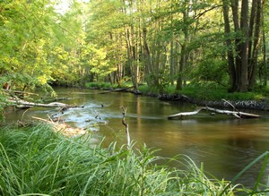
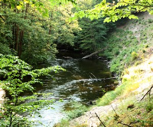
The river’s character is very diversified: from some slow segments in the wide-valley parts (ex. Prostynia – Rościn), to fragments of a large drop, rapid current and rocky bottom, reminiscent of mountain rivers. The natural environment surrounding Drawa is very interesting. The diverse character of Drawa itself is reflected in the diversity of its water vegetation and fish fauna. Certain segment represent the countries of trout, greyling, barbel, and bream.
Nearly 30 species of fish live in this river. The most co mmon ones in all its parts, however, are roach, perch, gudgeon, silver bream, two types of chub, and burbot. The most interesting fish of drawa, however uncommon are: brown trout, river trout, Eurasian minnow, white-finned gudgeon, and Baltic vimba. Until recently, the river was famous for its graylings that would often reach great sizes. In the years 1976-1997 an annual fishing competition used to take place here, called “The Grayling of Drawa” (“Lipień Drawy”). In the 1980, the Drawa segment south of Kamienna was home to salmon sprawning. After the species disappeared, an effort to reestablish it in Drawa was undertaken in 1995. This agenda is still in place.
This river also hosts some typical to clean water life: a red seaweed Hildenbrandtia rivularis (a red deposit on underwater rocks), sponges and moss animals, in shallower fragments there are meadows of crowfoot, sparganium, and pond-weed. In the protected fragment within the national park borders, one can observe natural processes that shape the river and its valley, such as landslides and landslips on the slopes, the shaping of the waterbed by trees fallen into the current.
The water purity in Drawa fits into the 1st class category by most physical and chemical standards. However, the presence of phosphates (an effect of insufficient purification of municipal and agricultural sewage waste) and the sanitary level of the river (fecal bacteria) do not allow to qualify Drawa any higher than 2nd or 3rd degree of purity.
The river has been used as a shipping trail since the 14th century. In 1662 its banks had been fortified, tree trunks removed from its current, and shallow fragments deepened. In 1700 Drawa was used for the transportation of honey from Drawsko to Frankfurt. The shipping trade remained until the Second World War, the longest in the segment Krzyż – Osieczno. People were already planning some projects to transform Drawa into a large-scale water trail. In 1708 a plan to establish a shipping trail Drawa – Rega was created. There were also plans for a canal to connect Drawa and Ina. In 1875 plans for a giant water trail Warta – Odra through Drawa, Ina, and Lake Dąbie were on the agenda.
Since the 18th century Drawa was being used on a large scale as a floating trail for timber obtained in the Drawa Wilderness. Along the banks there was made a system of over a dozen of rollways that remains still as a precious monument of the old forestry culture. The floating was finally abandoned in the 1970’s.
The river is also used for the purposes of generating electricity. In the end of the 19th century a carbide power-plant was built in Kamienna, later transformed into a water power-plant. In 1916 another power-plant, Borowo was build north of Prostyni. In the 1940’s there were plans to build a cascade of electric power-works (Barnimie, Zatom, Moczele, Mostniki, and the still existing Kamienna), however those plans never came into effect, luckily for the natural environment of Drawa and its valley.
In 1974 a 522ha large landscape nature reserve was established in the Drawa valley, from Lake Dubie to Kamienna power-plant. 10 sites within the reserve’s borders were put under strict protection. The creation of the Drava Reserve gave way to the intense efforts of natural scientists whose plans to establish a national park here came into fruition in 1990. In several stretches along the valley there are tourist trails: Drawno – Prostynia, Zatom – Drawno, and Głusko – Zatom. There is fishing and canoeing access to Drawa, but only in accordance to the strict rules and time limitations


