Park
General information
 The area of Drawa National Park and its neighbourhood lies in the a plain called Równina Drawska, which is a fragment of the lake district Pojezierze Południowopomorskie, in the north-western part of Poland. It encompasses for the central part of a forest complex called Drawa Wilderness (Puszcza Drawska). The DNP represents a landscape of early-glacial outwash plains. It lies entirely within the reception basin of Drawa River, which – along with its tributary Płociczna – constitute for its main hydrographic axis. Both these rivers run through a wide lane of outwashes that originated from the sands left by a melting glacier’s waters running down to the Toruń-Eberswald postglacial stream valley.
The Drawa National Park Layout:
- Longitude: 15º45' to 16º45' E
- Latitude: 53º00' to 53º15' N
Physical and Geographical localization of Poland in the J. Kondracki’s system:
- Mesoregion: Równina Drawska
- Macroregion: Pojezierze Południowopomorskie
- Sub-province: Pojezierze Południowopomorskie
- Province: Central-European Lowland
Distances to city centres:
The centre of the DNP is located in a strait-line distance to:
- Szczecin: 101 km
- Gorzów: 61 km
- Poznań: 97 km
- Wrocław: 230 km
- Łódź: 280 km
- Gdańsk: 235 km
- Warsaw: 360 km
All activities performed within the DNP borders have to conform to the rules of nature preservation.
The main function of the DNP is to observe the natural biotope and evaluate the current state of natural processes, surface and subterranean waters, climate, and other aspects of the inanimate nature. Based on those observations, we can forecast the direction and pace of ecosystem changes, and the reaction of live organisms to those changes.
The Park area is directly related to the Drawa reception basin of 567km². The rapid currents of these rivers have sculpted many attractive canyons and ravines wedged into the outwash plain, some close to 30 metres deep and overgrown with diverse standing timber. In those valleys take place the most crucial land-shaping processes: the river current is causing, on one side, spot erosion of the valley slopes, and on the other – accumulation of river residues on the dry ground forests on the drainage terraces.
The Drawa Wilderness, presently a dense forest complex, only 100 years ago used to be a mosaic of woods, pastures, and fields. Its present-day landscape has been shaped mainly by the traditional local economy, especially the forestry, of which some elements are now the relics of past human activities.
Among them are:
- A still noticeable complex of old rollways used to accumulate wood gathered in the wilderness
- Traces of old forest industries: wood distilleries and glass-works
- Stone road-signs
- Remains of canals once used to irrigate the forest meadows
A significant element in the cultural landscape of the Park is the remains of old human settlements, and cemeteries.
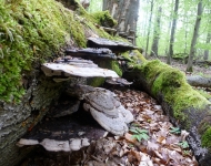
Presently, the DNP stands out for its diversity of ecosystems. There are 224 documented plant communities. The surface is dominated by forests (80% of the total park area), mainly beech woods, alder-lined meadows and swamps, and patches of pine forests. Another characteristic element is peatbogs, along with water and meadow ecosystems.
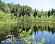
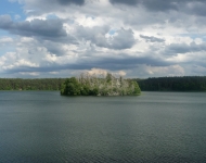
The lakes within the DNP are largely diversified by their trophicity, area, and depth. Some of them stand out with their characteristic fauna and flora.
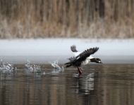
The Park’s fauna is represented by over 200 species of vertebrates, among which the most numerous are birds. There also is an abundance of invertebrates, among which one finds some uniquely valuable endangered species.
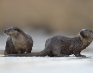
The crest animal of the DNP is the otter.



Search
Gallery
Newsletter
Będziemy informować Cię o nowościach w serwisie oraz ważnych wydarzeniach w Parku.
Contact
ul. Leśników 2, 73-220 Drawno,
tel.: (095) 768 20 51,
(095) 768 20 52
fax: (095) 768 25 10
email: [email protected]


