Z dniem 25 maja 2018 r. wchodzi w życie Rozporządzenie Parlamentu Europejskiego i Rady (UE) 2016/679 z dnia 27 kwietnia 2016 r. w sprawie ochrony osób fizycznych w związku
z przetwarzaniem danych osobowych i w sprawie swobodnego przepływu takich danych oraz uchylenia dyrektywy 95/46/WE. RODO obowiązywać będzie w identycznym zakresie we wszystkich krajach Unii Europejskiej, a więc także w Polsce i wprowadza szereg zmian
w zasadach regulujących przetwarzanie danych osobowych, które będą miały wpływ na wiele dziedzin życia. W tej informacji przedstawiamy skrót najważniejszych zagadnień dotyczących przetwarzania Twoich danych osobowych, jakie mogą mieć miejsce po 25 maja 2018 r. w związku z korzystaniem z naszych usług. Prosimy o jej przeczytanie.
Czym są dane osobowe
Dane osobowe to, zgodnie z RODO, informacje o zidentyfikowanej lub możliwej do zidentyfikowania osobie fizycznej. Takimi danymi są np. adres e-mail, adres IP lub Twoje dane w koncie poczty elektronicznej. Dane osobowe mogą być zapisywane w plikach cookies instalowanych przez nas na naszych stronach i urządzeniach, których używasz podczas korzystania z naszych usług.
Podstawa i cel przetwarzania
Przetwarzanie danych osobowych wymaga podstawy prawnej. RODO przewiduje kilka rodzajów takich podstaw prawnych dla przetwarzania danych, a w przypadkach korzystania
z naszych usług wystąpią co do zasady trzy z nich:
- Niezbędność przetwarzania do zawarcia lub wykonania umowy, której jesteś stroną. Umowa to regulamin danej usługi. Jeśli zatem zawieramy z Tobą umowę o realizację danej usługi, to możemy przetwarzać Twoje dane w zakresie niezbędnym do realizacji tej umowy. W przypadku, gdy zakładasz u nas konto poczty elektronicznej, to umowa o dostarczenie tego konta upoważnia nas do przetwarzania danych niezbędnych do jego zapewnienia (np. danych podanych przez Ciebie w profilu tego konta). Bez tej możliwości nie bylibyśmy w stanie zapewnić Ci usługi, a Ty nie mógłbyś z niej korzystać.
- Niezbędność przetwarzania do celów wynikających z prawnie uzasadnionych interesów realizowanych przez administratora lub przez stronę trzecią. Ta podstawa przetwarzania danych dotyczy przypadków, gdy ich przetwarzanie jest uzasadnione z uwagi na nasze usprawiedliwione potrzeby, co obejmuje między innymi konieczność zapewnienia bezpieczeństwa usługi (np. sprawdzenie, czy do Twojego konta nie loguje się nieuprawniona osoba), dokonanie pomiarów statystycznych, ulepszania naszych usług i dopasowania ich do potrzeb i wygody użytkowników.
- Twoja dobrowolna zgoda. Jest potrzebna głównie w przypadku, gdy usługi marketingowe dostarczają Ci podmioty trzecie oraz gdy to my świadczymy takie usługi dla podmiotów trzecich. Udzielenie takiej zgody jest całkowicie dobrowolne, i jeśli nie chcesz, nie musisz jej udzielać. Twoje pozostałe uprawnienia wynikające z udzielenia zgody są opisane poniżej.
Twoje dane, przetwarzane będą wyłącznie w przypadku posiadania przez nas lub inny podmiot przetwarzający dane jednej z dopuszczonych przez RODO podstaw prawnych
i wyłącznie w celu dostosowanym do danej podstawy. Twoje dane przetwarzane będą do czasu istnienia podstawy do ich przetwarzania – czyli w przypadku udzielenia zgody do momentu jej cofnięcia, ograniczenia lub innych działań z Twojej strony ograniczających tę zgodę, w przypadku niezbędności danych do wykonania umowy – przez czas jej wykonywania, a w przypadku, gdy podstawą przetwarzania danych jest uzasadniony interes administratora – do czasu istnienia tego uzasadnionego interesu.
Administrator danych
Administratorem Twoich danych osobowych jest Drawieński Park Narodowy z siedzibą
w Drawnie, który przetwarza dane w celu realizacji zadań ustawowych i statutowych. Administrator danych, może przekazać dane osobowe upoważnionym podmiotom na podstawie przepisów prawa. Każdej osobie, której dane dotyczą, przysługuje prawo do uzyskania informacji o zasadach przetwarzania, kontroli, poprawiania i zabezpieczenia danych w oparciu o art. 32 ustawy.
Twoje uprawnienia
Zgodnie z RODO przysługują Ci następujące uprawnienia wobec Twoich danych i ich przetwarzania przez nas i Zaufanych Partnerów.
Jeśli udzieliłeś zgody na przetwarzanie danych możesz ją w każdej chwili wycofać.
Masz również prawo żądania dostępu do Twoich danych osobowych, ich sprostowania, usunięcia lub ograniczenia przetwarzania, prawo do przeniesienia danych, wyrażenia sprzeciwu wobec przetwarzani danych oraz prawo do wniesienia skargi do organu nadzorczego – GIODO. Uprawnienia powyższe przysługują także w przypadku prawidłowego przetwarzania danych przez administratora.
Zgoda
Jeśli chcesz zgodzić się na przetwarzanie przez Drawieński Park Narodowy Twoich danych osobowych, możesz w łatwy sposób wyrazić tę zgodę, klikając w przycisk „Przejdź dalej” lub zamykając to okno. Wyrażenie zgody jest dobrowolne.


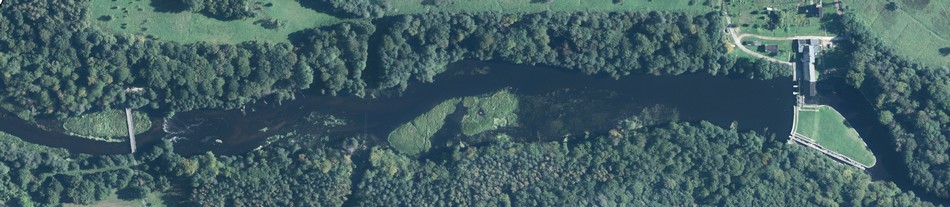
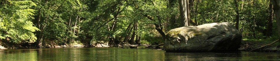

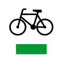
 Bike tours in the Drawa forests are a good way to get to know the area. About 80 km of bicycle routes, and about 90 km of walking trails has been marked within the DNP, the latter also available for biking. Trails within within the DNP are available all year round, from dawn to dusk.