


History of the area
The richness of the natural value of the Drawa National Park contributes to the fact that the anthropogenic value is often escapes the observers’ attention. Although there is a shortage of famously known monuments on this territory, some interesting, however smaller, elements of human activity and traces of the times past contribute to the uniqueness of this landscape.
The material remains of this population’s heritage are the systems of rollways used by raftsmen to store wood. The system consisted of storage and a slide. From the 18th century through the 1970’s, Drawa was being used as timber floating trail. The rollways are a visible landscape element where the river touches the forest complex. They are now precious monuments of the old forest culture and some are being used as camping fields.
Drawa was being used as a boating trail since the 14th century. As early as in 1662, the river was being cleared of tree stumps, the banks were being fortified, and the river deepened in where there were the old fords. In the 1700, Drawa was used for transporting honey from Drawsko to Frankfurt. The shipping trade lasted here until the Second World War, the longest on the stretch between Osieczno and Krzyż.
The old routes, and the cobble stone forest roads, are of a monumental character. They were adopted for wood transportation in the 19th century. Those routes are long stretches in the western part of the wilderness (Moczele – Osieczno, Moczele – Wygon, and Zatom – Radachowo), and shorter ones that fortified the sandy surfaces and driveways in the eastern part. Besides that, through the present area of the DNP and its surroundings used to run some important communication trails:
- the Margraviate road through Mirosławiec to Czaplinek,
- the salt trail through Moczele towards Pomerania,
- the route Berlin – Barnimie – Dominikowo – Mirosławiec – Gdańsk,
- the route Stargard – Recz – Drawno – Sieniawa – Wałcz (Brzustowicz, 1998).
The decisive elements in the character of these forests are unassuming objects scattered in the Drawa Wilderness, such as: stone road signs (especially numerous in the Zatom – Wygon area, and north of Lake Szczucarz, to Jeleni Róg), brick chapels, tree-trunk water pumps, and the remains of fire-lines (Bory Dominikowskie, and the Sitnica area).
In the forests of the Drawa Wilderness, there are many locations remaining after old human settlements. Their location today is only recognizable by what seems like a human-planted growth, and some old Evangelical cemeteries. They date predominantly to the mid-19th century. They are often very picturesquely situated, among some valuable old trees, with visible borders of the contemporary land divisions, usually, however, consisting of destroyed graves. The local church cemetery near Ostrowiec, along with the church and bell-tower ruins, was included in the register of local monuments.
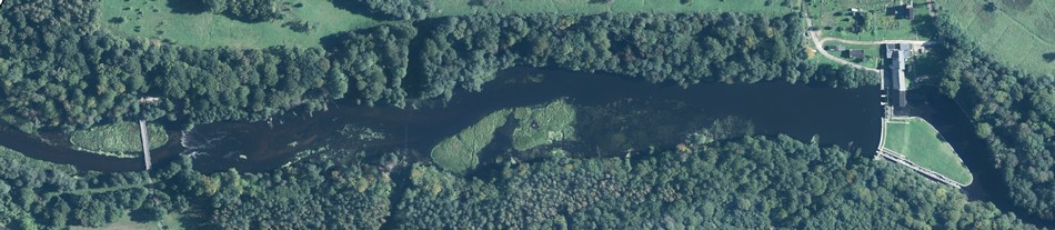
In the old days, rivers of the Park and its surroundings were used for water mills, sawmills, starch factories, small power plants, and many bridges. What remained of them to this day are ruins, or just fragments of those buildings. One interesting vintage point is the so-called “eelery” (“węgornia”), where remain the ruins of an old mill, relics of a dam, and ruins of the ell receptacles, where the ells were hauled in nets. Also interesting, however unassuming, are some hydro-technical objects, such as the irrigating canals: Głuchy, Sicieński, Suchy, and one in the northern part of the Park, in the valley of Rudnica and Płociczna. The most interesting canal is Sicieński. It runs from Lake Sitno, at the right bank of River Płociczna, around Lakes Płociczno and Ostrowieckie, all the way to the meadows of Drava Valley near Głusko. The canal came into being around 1820, and was an initiative of Fredrick von Sydov. It was used until the Second World War to irrigate meadows near Miradz and Głusko. Siecieński Canal is about 22 km long. It runs through hill slopes, and the river valley traverse, high up above the lakes – just by their banks, and in some stretches away from the coastal lines, as an aqueduct running above the meadows. It is a characteristic example of hydro-technical architecture from the beginning of the 19th century. It constitutes for the basic element of the so-called “jump-back” structure of the drainage system. It was renovated after being destructed during the war: the isolation layer was removed to deepen the river bed. The attempts to irrigate the canal failed and it remains dry to this day.
There are remains of old pond farms in the Park area, and they are:
- Rybakówki ponds and Głuchy canal
- remains of the “Zawiślak’s Ponds”, “UFO Ponds”, the ponds in Rynna Moczelska, the ponds west of Lake Kocie,
- the “beadwork” ponds at Sucha.
Among the engineering monuments of the Drawa forests are:
- water power plant with a water wheel on Płociczna in Pustelnia
- remains of the forest railroad Springe – Sitnica – Jelenie – Krępa
- a forest technology complex in Głusko: a blacksmith’s shop, brewery, rifle-range, waterworks, and a place where there used to be a mill
- remains of an old complex of paper factories and mills Bogdanka – Jaźwiny – Sówka.
Worthy of attention is also an object that used to serve as water power plant, paper factory, tar and wooden wool factory in Jaźwiny (near the Park), built in 1814. Paper production was in place until 1979; then paper was replaced with tar, and from 1871 – wooden wool, used for glass packaging. Seventy years later that factory building was adopted for the needs of a neighbouring trout farm. After many changes and renovations, that building complex kept functioning as industrial. It remained in a good condition to this day; only the boiler-room and the industrial chimney were damaged. Among those industrial buildings worthy of attention are the brewery in Głusko and a cheese factory in Sitno. The brewery was built around 1820, and after 1849 the building had been used as a protestant church. Inside the church walls one can still notice traces of the rebuilding fazes. The Sitno cheese factory was built in 1870. Since the 1870’s it was used for the “Głusko cheeses” production, and they were later produced in Głusko. In 1945 the cheese factory stopped functioning, and what remains of it is the production/accommodations building.
The most interesting industrial monument in the DNP area is the Kamienna electricity plant with the power of 0,96 MW. It came into being in 1903, replacing an old carbide factory. The building of the water power plant was started in 1879, with a water ledge next to the carbide factory, above the mill’s water ledge. The building complex consists of the power plant, a barren weir, an earth dam, a fish-pass, an incline for wood-drifting, a water body, and a distribution room with a transformer station. “Kamienna” is a representative example of an early-20th century hydro-electric plant. It has outstanding historical and technological value, for the equipment was kept intact: the two hydrocomplexes with Francis turbines by Escher Wyss from Switzerland, the AEG production generators from Berlin, and the Voith system regulators.
In Pomerania, including the area being described, from the 17th to 18th century, small glass-works were popular. The necessary elements came from wild forests: glass sands, moldable clays, calcium, and beech wood. Those small factories were located near Głusko, Podszkle, and at the joining point of rivers Cieszynka and Płociczna. The only remaining traces of those glass factories are scattered pieces of glass materials.
The Pomorski (Pomeranian) Embankment – a German fortification wall built along the former border of Poland and Germany in the years 1935-38 – runs through the eastern part of the Drawa National Park. That is the territory between Tuczno and the mouth of Mierzęcka Struga, where the monuments of the Embankment remain. They are fortification elements such as: shelters, dams, observation towers, field traps (anti-tank ditches and mounds), and a line of trenches. Combat shelters are the most numerous monuments there. Military buildings of the Pomorski Embankment within the DNP area are a sightseeing attraction buried deep in the woods. The largest concentration of these fortifications can be found near Stare Osieczno, and also (on a smaller scale) near Rybałówka, Lake Ostrowieckie, Pustelnia, and Gwiazda