

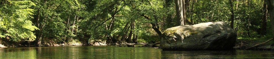

Hiking trails
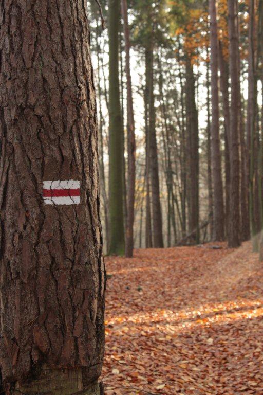 Wandering through the woods of Drawa Forest is the best way to know that area. Within the area of the Drawa National Park about 90 kilometres of walking trails have been set out that are available all year round, from dawn to dusk, also for cycling and cross-country skiing.
|
Attention! |
| The red trail Dedicated to St. Czarniecki Szczecin - Stare Osieczno - Kostrzynn |
The total length of the route: 125.06 km (to Buki Zdroiskie)
Length within the DNP: 32.69 km
Estimated time to walk the trail within the DNP: 7 godz.
Estimated time to bike the trail within the DNP: 3 godz. 45 min.
Itinerary:
Drawno → Drawnik → Barnimie → Barnimie camping site → Drawski Matecznik Strictly Protected Area → Zatom (the green trail Zatom – Nowa Studnica and „Międzybór” educational trail) → Święta Hala (Wydrzy Głaz) → Radęcin → Moczele (the blue trail Moczele – Ostrowieckie lake) → Głusko (Pustelnia – Głusko rail), Kamienna power station → Stare Osieczno
| The red trail Dedicated to IV Infantry Division Człopa - Tuczno - Nadarzyce |
The total length of the route: 96.63 km (to Dobre lake)
Length within the DNP: 15.95 km
Estimated time to walk the trail within the DNP: 3 hours 40 minutes
Estimated time to bike the trail within the DNP: 2 hours 30 minutes (the walking trail within the DNP is not available for bikes in the section Pustelnia- " Śmiałkowe Wzgórza" viewing site).
Itinerary:
Człopa → Pustelnia (the yellow trail Pustelnia - Głusko) → bridge on the Płycina River (the blue trail, bridge near Miradz - Prostynia) → „Śmiałkowe Wzgórza” viewing site → Marta lake → Martwica (the blue trail Martwica – Krępa Krajeńska)→ Martew → Tuczno
| The blue trail Cieszynka Valley - Czarne lake- Jagoda |
The total length of the route: 9.48 km|
Length within the DNP: 7.68 km
Estimated time to walk the trail within the DNP: 1 hour 45 min.
Estimated time to bike the trail within the DNP: 1 hour.
Itinerary:
Cieszynka Valley → bridge behind Węgornia (the red trail Człopa - Tuczno - Nadarzyce) → punkt widokowy „Stara Węgornia” ( „Jezioro Ostrowieckie” [Ostrowieckie lake] educational rail) → Ostrowite settlement (the Black trail Ostrowieckie Lake - Ostrowite settlement) → Czarne lake → Karolinka bridge → Jagoda
|
The blue trail |
The total length of the route: 7.62 km
Length within the DNP: 2.41 km
Estimated time to walk the trail within the DNP: 45 min.
Estimated time to bike the trail within the DNP: 20 min.
Itinerary:
Martwica (the red trail Człopa - Tuczno - Nadarzyce) → Głodne Jeziorka [Hungry Lakes] Strictly Protected Area → bridge on the Runica river
| The blue trail bridge near Miradz - Drawno - Prostynia |
The total length of the route: 43.37 km
Length within the DNP: 0.57 km
Estimated time to walk the trail within the DNP: 5 min.
Estimated time to bike the trail within the DNP: 2 min.
Itinerary:
Bridge on the Płociczne river (Płycina) near Miradz (the red trail Człopa - Tuczno - Nadarzyce) → Miradz
| The blue trail Moczele - Ostrowieckie Lake |
The total length of the route: 4.19 km
Length within the DNP: 4.19 km
Estimated time to walk the trail within the DNP: 55 min.
Estimated time to bike the trail within the DNP: 30 min.
Itinerary:
Moczele (the red trail Szczecin - Stare Osieczno - Kostrzyn)) → Ostrowieckie lake (the yellow trail Pustelnia - Głusko).
| The black trail Ostrowieckie Lake – Ostrowite settlement (Ostrowiec) |
The total length of the route: 2.0 km
Length within the DNP: 2.0 km
Estimated time to walk the trail within the DNP: 25 min.
Estimated time to bike the trail within the DNP: 13 min.
Itinerary:
Ostrowieckie Lake (the yellow trail Pustelnia - Głusko, the blue trail Cieszynka Valley - Jagoda) → Ostrowite settlement.
| The yellow trail Pustelnia - Głusko |
The total length of the route: 10,57 km
Length within the DNP: 10,57 km
Estimated time to walk the trail within the DNP: 2 hours20 min
Estimated time to bike the trail within the DNP: 1 hour 15 min. (the walking trail within the DNP is not available for bikes in the section Pustelnia- Ostrowieckie lake).
Itinerary: Pustelnia (the red trail Człopa - Tuczno - Nadarzyce) → western shore of Ostrowieckie lake→ Głusko (the red trail Szczecin - Stare Osieczno - Kostrzyn).
| The yellow trail Człopa - Stare Osieczno - Wierzbno |
The total length of the route: 19.38 km
Length within the DNP: 5.88 km
Estimated time to walk the trail within the DNP: 1 hour 40 minutes.
Estimated time to bike the trail within the DNP: 50 minutes.
Itinerary: Jagoda (the blue trail Cieszynka Valley - Jagoda) → Stare Osieczno
| The green trail Zatom - Nowa Studnica |
The total length of the route: 24.02 km
Length within the DNP: 3.96 km
Estimated time to walk the trail within the DNP: 45 min.
Estimated time to bike the trail within the DNP: 30 min.
Itinerary: Zatom (the red trail Szczecin - Stare Osieczno - Kostrzyn, „Międzybór” educational trail ) → Międzybór forestry→ Jaźwiny → Bogdanka